Amirante Islands
Coral island group in Seychelles, discovered by Vasco da Gama in 1503.

The Amirante Islands (Les Amirantes) are a group of coral islands and atolls that belong to the Outer Islands of the Seychelles. They stretch about 155 km from the African Banks (African Islands) in the north to Desnœufs (Isle des Noeufs) in the south, all on the shallow Amirantes Bank (Amirantes Plateau, with depths of mostly 25 to 70 m), except the main island Île Desroches in the east, and submerged Lady Denison-Pender Shoal at the northern end. 90 km south of the Amirante Islands is Alphonse Group, the closest group of islands, which are sometimes considered part of the Amirantes.
- discovered by
- Vasco da Gama (1503)
Verified Timeline
Lore & Background
The Amirantes were discovered by Vasco da Gama on his second voyage of exploration in 1503, and later named 'Ilhas do Almirante' (Admiral Islands). Previous knowledge of the islands by Arab and Indian traders is possible. The islands were claimed by Sieur Michel Blin for France in 1802. By the Treaty of Paris (1814), the islands were passed officially to the British, as a part of Mauritius. In 1909, the Seychelles became a separate colony, thereby including the Amirantes. On 8 November 1965 the United Kingdom split Île Desroches from the Seychelles to become part of the newly created British Indian Ocean Territory. The purpose was to allow the construction of a military base for the mutual benefit of the United Kingdom and the United States. On 23 June 1976 Île Desroches was returned to the Seychelles as a result of the latter attaining independence.
Reader's Guide
The Amirante Islands are a remote coral archipelago within the Outer Islands of the Seychelles, with a total land area of 11.5 km² and a total population of 300. Their discovery by Vasco da Gama in 1503 marks them among the earliest European-discovered islands in the Indian Ocean, though prior knowledge by Arab and Indian traders is possible. The islands' colonial history reflects the broader geopolitical shifts in the region: claimed by France in 1802, passed to Britain in 1814 as part of Mauritius, and later incorporated into the Seychelles colony in 1909. The archipelago comprises eight single islands (five low sand cays and three uplifted sand cays), plus three atolls with a total of 18 islets (St. Joseph Atoll with 14, Desroches with 1, Poivre Atoll with 3). The five largest ones in area are inhabited. The biggest concentrations are the Prison 2 km from Marie Louise village and the Collins group construction camp which is 2 km from the capital village of Desroches village (which had a population of 35 in the last census).
Did You Know?
- The Amirantes were discovered by Vasco da Gama on his second voyage of exploration in 1503.
- The islands were named 'Ilhas do Almirante' (Admiral Islands) by Vasco da Gama.
- Île Desroches was part of the British Indian Ocean Territory from 8 November 1965 to 23 June 1976.
- The total land area of the Amirante Islands is only 11.5 km².
- The capital village of Desroches had a population of just 35 in the last census.
Geography & Physical Layout
The Amirante Islands form a scattered chain of coral formations belonging to the Seychelles' Outer Islands, stretching roughly 155 km from the African Banks (African Islands) in the north down to Desnœufs (Isle des Noeufs) in the south. Nearly the entire group rests on the shallow Amirantes Bank (Amirantes Plateau), where seabed depths typically range between 25 and 70 m, giving the archipelago its distinctive low-lying character. The notable exception is Île Desroches, the largest and most prominent island, situated to the east, while a submerged feature known as Lady Denison-Pender Shoal marks the northernmost end. The group comprises eight single islands—five low sand cays and three uplifted sand cays—alongside three atolls that together host 18 islets. St. Joseph Atoll alone accounts for 14 of those islets, while Desroches Atoll holds just 1 and Poivre Atoll 3. A reef and a shoal without islets are also catalogued for completeness. In total, the land area amounts to 11.5 km², and only the five largest units support human habitation. 90 km south of the Amirante Islands is Alphonse Group, the closest group of islands, which are sometimes considered part of the Amirantes chain because they are a southern continuation or extension of the Amirantes chain. Alphonse Group lies south of the Amirantes Bank, separated from it by deep water (generally 1000 to 2000 metres deep).
History & Colonial Legacy
The Amirantes first entered European records when Vasco da Gama sighted them during his second voyage of exploration in 1503, naming them 'Ilhas do Almirante' (Admiral Islands). It is possible that Arab and Indian traders had already known of the islands long before that Portuguese encounter. Formal colonial claims came much later: in 1802, Sieur Michel Blin asserted French sovereignty over the group. The Treaty of Paris in 1814 then transferred the islands to British control, as a part of Mauritius. When the Seychelles became a separate colony in 1909, the Amirantes fell under its jurisdiction. The most dramatic chapter unfolded on 8 November 1965, when the United Kingdom split Île Desroches from the Seychelles and incorporated it into the newly created British Indian Ocean Territory. The purpose was to allow the construction of a military base for the mutual benefit of the United Kingdom and the United States. That arrangement lasted barely a decade; on 23 June 1976, following Seychelles independence, Île Desroches was returned to the Seychelles.
Population & Settlement
Despite spanning a 155 km stretch of the Indian Ocean, the Amirante Islands are home to only around 300 people in total, making them among the most sparsely populated territories in the Seychelles. The capital village, Desroches, recorded a population of just 35 in the last census, underscoring how small the settled communities truly are. Marie Louise is another named village within the group. The two largest concentrations of people beyond the villages are a prison facility located roughly 2 km from Marie Louise village and a construction camp operated by the Collins group, situated about 2 km from Desroches village. Only the five largest islands in the group are inhabited, while the remaining cays, atolls, and islets stay unoccupied. The overall land area of just 11.5 km² further limits how many residents the archipelago can realistically sustain, and the scattered distribution of settlements across such a wide geographic span means that daily life in the Amirantes is defined by isolation and small-scale community.
The Alphonse Group & Broader Context
Ninety kilometres to the south of the Amirante Islands lies the Alphonse Group, the closest group of islands, and one that is sometimes considered part of the Amirantes chain because they are a southern continuation or extension of the Amirantes chain. However, the two groups are separated by a substantial band of deep ocean water, with depths generally ranging from 1000 to 2000 metres, which sets the Alphonse Group apart geologically from the shallow Amirantes Bank on which the main archipelago sits. This deep-water gap means that while the Alphonse Group may be treated as a continuation of the Amirantes in some administrative or geographic contexts, it occupies a distinctly different physical setting. The Amirantes themselves, by contrast, rest almost entirely on the shallow plateau with depths of mostly 25 to 70 m, giving them a fundamentally different marine environment. Whether one regards the Alphonse Group as part of the Amirantes or as a separate entity, the two together form the outermost reaches of the Seychelles' island chain in the southern Indian Ocean.
Frequently Asked Questions
What are the Amirante Islands?
The Amirante Islands (Les Amirantes) are a chain of coral islands and atolls that make up part of the Outer Islands of the Seychelles. They rest on the shallow Amirantes Bank and extend roughly 155 km from the African Banks in the north to Desnœufs in the south.
Who discovered the Amirante Islands?
Portuguese explorers first sighted the group around 1501–1502, though the specific individual credited with the discovery is still debated. The islands were later called 'Ilhas do Almirante' (Admiral Islands) in Portuguese, a name that eventually became 'Amirante.'
Where are the Amirante Islands located?
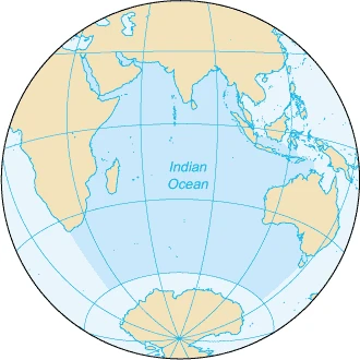
They sit in the Indian Ocean as part of Seychelles' Outer Islands, positioned on the broad, shallow Amirantes Bank. The main island Île Desroches lies to the east, while the submerged Lady Denison-Pender Shoal marks the northernmost extent of the group.
What is the colonial history of the Amirante Islands?
After the early Portuguese sighting, the islands were formally claimed for France in 1742 by Lazare Picault. They subsequently changed hands through later colonial arrangements and ultimately became part of the modern Republic of Seychelles.
What makes the Amirante Islands geographically notable?
The group is distinguished by its position on the Amirantes Bank, a wide shallow seafloor platform in the central Indian Ocean. At roughly 155 km in length, it is one of the more elongated island chains within the Seychelles archipelago.
More in Islands Of The Indian Ocean 1-24
Related in Islands Of The Indian Ocean
Links follow this subject's own source article.
Spotted an error? Know more?
This is a living reference — every entry is fact-audited, and reader corrections feed straight into our audit queue. Suggest an edit · See this site's audit record