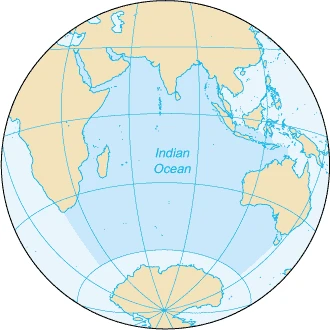
Balleny Islands
Uninhabited volcanic islands south of the Antarctic Circle.

The Balleny Islands are a series of uninhabited, heavily glaciated volcanic islands in the Southern Ocean, extending roughly 160 km in a northwest–southeast direction. Discovered in 1839 by English sealing captains John Balleny and Thomas Freeman, they were the site of the first recorded human landfall south of the Antarctic Circle. The group is claimed by New Zealand as part of the Ross Dependency.
- location
- 66°15' to 67°35'S, 162°30' to 165°00'E
- area
- 400 km² (154 mi²)
- highest_point
- Brown Peak, approximately 1,500–1,705 m (5,000–5,594 ft)
- discovery
- 1839 by John Balleny and Thomas Freeman
- first_landfall
- 9 February 1839 by Thomas Freeman
- claimed_by
- New Zealand (Ross Dependency)
- volcanic_status
- Possibly active; Brown Peak may have erupted in 2001
Verified Timeline
Lore & Background
The Balleny Islands were first sighted in 1839 by English sealing captains John Balleny and Thomas Freeman. Balleny named the group after himself and the individual islands after London merchants who financed the expedition. On 9 February 1839, Freeman became the first person known to land on any of the islands, marking the first recorded human landfall south of the Antarctic Circle. Sealers sighted the islands in 1853 but did not land. In 1948, the Australian National Antarctic Research Expeditions surveyed the islands aboard HMAS Wyatt Earp, with a landing party led by Stuart Campbell on 29 February 1948, apparently the first people to set foot there since 1839. In February 2015, the New Zealand-Australia Antarctic Ecosystems Voyage aboard RV Tangaroa visited for three days to study marine life, particularly humpback whales, following up on work from 2010. On 3 February 2017, the Swiss Polar Institute's Antarctic Circumnavigation Expedition conducted photographic and video surveys, mostly by helicopter, with some landings via Zodiac boats.
Reader's Guide
The Balleny Islands hold significance as a remote, uninhabited archipelago that marks an early milestone in Antarctic exploration—the first recorded human landfall south of the Antarctic Circle. Their volcanic origin, associated with the Balleny hotspot, and ongoing potential activity (including a possible 2001 eruption of Brown Peak) make them geologically notable. The islands support colonies of Adelie and chinstrap penguins, particularly on Buckle and Sabrina Islands. Their extreme weather, with powerful winds and only about 15 days of blue sky per year, underscores their inhospitable nature. The islands are claimed by New Zealand under the Ross Dependency, and their surrounding waters contain submerged features such as the Balleny Seamounts and Balleny Trough. Modern scientific visits, including ecosystem studies and mapping efforts, continue to expand knowledge of this isolated region, though much remains unexplored.
Did You Know?
- The Balleny Islands were the site of the first recorded human landfall south of the Antarctic Circle, made by Thomas Freeman on 9 February 1839.
- The highest point, Brown Peak on Sturge Island, remains unclimbed.
- A magnitude 8.1 earthquake struck over 700 km west-northwest of the islands in 1998, altering seismicity patterns across a wide area.
- The islands experience an average of only 15 days of blue sky per year.
- Satellite observations suggest Brown Peak may have erupted as recently as 2001.
Geography & Volcanic Landscape
The Balleny Islands stretch roughly 160 kilometers in a northwest-to-southeast arc across the Southern Ocean, spanning latitudes from 66°15' to 67°35'S and longitudes from 162°30' to 165°00'E. The archipelago's total land area is approximately 400 square kilometers, dominated by three principal islands—Young, Buckle, and Sturge—arranged in a near-linear fashion, with numerous smaller islets and rocky outcrops scattered around them. All three major islands are stratovolcanoes born from what geologists call the Balleny hotspot, and their slopes remain heavily draped in glaciers that plunge directly into the surrounding sea. The highest point, the unclimbed Brown Peak on Sturge Island, has been measured at somewhere between 1,500 and 1,705 meters above sea level. The Antarctic Circle passes remarkably close to Borradaile Island, threading through the eight-kilometer channel separating Young and Buckle. The islands sit within a region of powerful, persistent winds and overcast skies, with clear blue skies averaging just fifteen days per year.
Discovery & the Long Silence
In 1839, English sealing captain John Balleny and his companion Thomas Freeman became the first humans to sight this remote archipelago. Balleny named the group in his own honor, while the individual islands received names drawn from the London merchants who had financed the sealing venture. On 9 February 1839, Freeman made what is recorded as the first human landfall south of the Antarctic Circle, stepping onto one of the islands in a small boat. For the next decade and a half, the islands remained largely untouched by people; sealers spotted them again in 1853 but chose not to make landfall. Then came a remarkable gap: the next confirmed human presence on the islands did not arrive until 29 February 1948, when a small landing party under Stuart Campbell, part of the Australian National Antarctic Research Expeditions aboard HMAS Wyatt Earp, set foot on the rocks in a whaleboat. That single landing represented the first time in nearly a century that anyone had walked on Balleny soil since the original 1839 discovery.
Modern Scientific Expeditions
The Balleny Islands have drawn a steady trickle of scientific attention in the modern era, each visit building on the last. In 2010, researchers first studied the marine ecosystems surrounding the archipelago, and in February 2015 a three-day expedition under the New Zealand-Australia Antarctic Ecosystems Voyage returned aboard the RV Tangaroa, operated by New Zealand's National Institute of Water and Atmospheric Research. The 2015 team focused particularly on humpback whale behavior in the waters around the islands. Then, on 3 February 2017, personnel from the Swiss Polar Institute's Antarctic Circumnavigation Expedition arrived to conduct extensive photographic and video documentation aimed at producing the first accurate maps of the main islands. Much of their survey work was carried out by helicopter, though at least one landfall was also made using Zodiac inflatable boats. These successive missions have transformed the Balleny Islands from a curiosity of the sealing era into a subject of ongoing ecological and cartographic study.
Seismic Restlessness & Possible Eruption
Though the Balleny Islands sit far from major tectonic boundaries, they are not immune to the restless forces of the Earth's crust. Moderate tremors do register along the Pacific-Antarctic Ridge, the Macquarie triple junction, and the Pacific Rim in the stretch of ocean between the Balleny Islands and Macquarie Island. Additional seismic activity occurs near the Southeast Indian Ridge and the Balleny fracture zone. The most dramatic event in recorded history was a magnitude 8.1 earthquake in 1998, striking more than 700 kilometers to the west-northwest of the archipelago. That single quake reshaped the pattern of seismicity across a vast surrounding region. Perhaps most intriguingly, the islands may still be volcanically alive. Satellite observations have suggested that Brown Peak, the unclimbed summit on Sturge Island, may have experienced an eruption as recently as 2001, hinting that the volcanic engine beneath the Balleny hotspot has not fully gone dormant.
Frequently Asked Questions
What are the Balleny Islands?
The Balleny Islands are a chain of uninhabited, heavily glaciated volcanic islands stretching roughly 160 km in a northwest-to-southeast line in the Southern Ocean. They cover about 400 square kilometres, with Brown Peak rising to around 1,500–1,705 metres as the highest point.
Who discovered the Balleny Islands?
English sealing captains John Balleny and Thomas Freeman first sighted the archipelago in 1839. Thomas Freeman made the initial recorded landfall on 9 February 1839, giving the group its name.
Where exactly are the Balleny Islands located?
They sit between roughly 66°15′ and 67°35′ south latitude and 162°30′ and 165°00′ east longitude, placing them well south of the Antarctic Circle in the open Southern Ocean.
Why are the Balleny Islands historically significant?
They hold the distinction of being the site of the first documented human landfall south of the Antarctic Circle, achieved by Freeman in 1839. That milestone made the islands a landmark moment in early polar exploration.
Who currently claims the Balleny Islands?
New Zealand asserts sovereignty over the group as part of its Ross Dependency territory. The islands remain entirely uninhabited and heavily glaciated, with no permanent settlement or infrastructure.
More in Islands Of The Indian Ocean 1-24
Spotted an error? Know more?
This is a living reference — every entry is fact-audited, and reader corrections feed straight into our audit queue. Suggest an edit · See this site's audit record