Comoro Islands
Volcanic archipelago in the Mozambique Channel, partly independent, partly French.

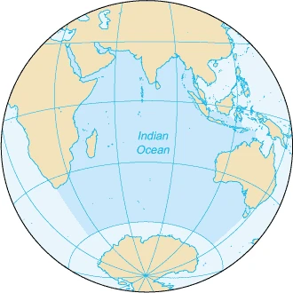
The Comoro Islands are a group of volcanic islands in the Mozambique Channel, an arm of the Indian Ocean lying between Madagascar and the African mainland. Three of the islands form the Union of the Comoros, a sovereign nation, while Mayotte belongs to France. These volcanic islands, covering a total area of 2034 km², include Ngazidja (Grande Comore), Ndzuwani (Anjouan), Mwali (Mohéli), and Mayotte (Maore), the latter a French overseas department composed of Grande-Terre and Petite-Terre. The Glorioso Islands were administratively attached before 1975 and geologically form part of the archipelago.
- Area
- 2034 km² (785 sq mi)
- Largest Island
- Ngazidja (Grande Comore)
- Highest Point
- Karthala volcano, 2361 m (7746 ft)
- Climate
- Tropical maritime, average 26°C at sea level
- Number of Main Islands
- 4 (Ngazidja, Ndzuwani, Mwali, Mayotte)
- Sovereign State
- Union of the Comoros
- French Territory
- Mayotte (overseas department)
Verified Timeline
Lore & Background
The Comoro Islands may have been settled as early as the 6th century by Bantu-speaking peoples, Austronesian groups (including Malagasy), Arabs, Somalis, Portuguese, French, and Indians. Islam probably arrived during the 10th century. The islands formed, with Zanzibar, Pemba, Lamu, and coastal towns of Kenya and Tanzania, a united and prosperous region of Swahili culture, trading local goods to the African coast, Madagascar, the Middle East, and India. Portuguese explorers made landfall on the Islands of the Moon in 1505; 'kamar' is Arabic for moon. During the colonial period, French settlers established plantations producing sugar, then perfume plants and spices such as ylang-ylang, vanilla, and cloves, as well as copra. In 1946, France redefined the Comoros as a French overseas territory. A 1974 referendum saw the population vote overwhelmingly for independence except in Mayotte, which remained French. The three other islands formed the Etat Comorian, later the Federal Islamic Republic, and today the Union of the Comoros. In 1997, demands for autonomy on Ndzuwani and Mwali led to the breakup of the Federal Islamic Republic. A 2001 constitution gave each island more autonomy. In 2008, the President of Anjouan refused free elections and was forced to flee after military intervention by Comorian and African Union troops. Mayotte officially became France's 101st department on 31 March 2011.
Reader's Guide
The Comoro Islands are significant as a crossroads of African, Arab, and Indian Ocean cultures, reflected in their diverse population and Swahili heritage. Geologically, they are volcanic islands formed in the Tertiary and Quaternary periods, with Grande Comore still active via the Karthala shield volcano, which rises to 2361 meters. The archipelago's ecology includes endemic species such as Livingstone's fruit bat (Pteropus livingstonii), discovered by David Livingstone in 1863, and the Comoro rousette (Rousettus obliviosus), as well as native lemurs like the mongoose lemur and common brown lemur. Environmental pressures include habitat loss from human settlement and invasive species like guava trees. Politically, the islands illustrate the complexities of decolonization: three islands form the independent Union of the Comoros, while Mayotte chose to remain French and became an overseas department. The Union has faced secessionist movements and constitutional reforms to increase autonomy. The 1996 hijacking of Ethiopian Airlines Flight 961, which crashed off the shore of Grande Comore killing 125 people, is a notable tragedy. The islands' economy historically relied on plantation crops like ylang-ylang, vanilla, and cloves.
Did You Know?
- The Comoro Islands are named from the Arabic 'kamar' meaning moon, as noted by Portuguese explorers in 1505.
- Livingstone's fruit bat (Pteropus livingstonii), discovered by David Livingstone in 1863, is endemic and reduced to about 1,200 specimens on Anjouan and Moheli.
- Karthala, a shield volcano on Grande Comore, has a summit caldera approximately 3 km × 4 km in size.
- In 1996, Ethiopian Airlines Flight 961 was hijacked and crashed off the shore of Grande Comore, killing 125 people; 50 survived.
- Mayotte became France's 101st department on 31 March 2011, after a referendum on 29 March 2009.
Volcanic Origins and Island Formation
The Comoro Archipelago consists of volcanic islands. These volcanic islands, together with the high mountains in the north of Madagascar, were formed in the Tertiary and Quaternary periods. Mayotte is the oldest island still above sea level and underwent three volcanic phases between 15 million and 500,000 years ago. The ages progressively decrease from east to west. Grande Comore is the youngest island and is still volcanically active. Karthala, a shield volcano occupying some two thirds of the island, rises to 2361 meters. The summit caldera is quite large, being approximately 3 km × 4 km in size at the rim. Notable reefs include Banc Vailheu, a submerged volcano located 20 km west of Grand Comoros; Banc du Geyser, a reef measuring 8 by 5 km, situated 130 km north-east of Grande-Terre; and Banc du Leven, a former island between Madagascar and Grande-Terre which is now submerged.
A Crossroads of Cultures and Trade
The Comoro Islands may have been settled as early as the 6th century. Among the peoples who crossed the sea to populate the islands are Bantu-speaking peoples, Austronesian (including Malagasy), Arabs, Somalis, Portuguese, French, and Indians. Islam probably arrived during the 10th century. The Comoro Islands formed, with Zanzibar, Pemba, Lamu, and the coastal towns of Kenya and Tanzania, a united and prosperous region of Swahili culture, trading in local goods which were exported to the African coast, Madagascar, the Middle East and India. In that period, political power was in the hands of local rulers. During their explorations of the Comoros region, the Portuguese made landfall on the Islands of the Moon, in 1505; kamar is Arabic for moon. During the colonial period, French settlers established plantations, initially producing sugar, an intensive process dependent on the labor of numerous Africans. In the twentieth century, they cultivated perfume plants and spices, such as ylang ylang, vanilla and cloves, as well as copra.
The Road to Independence and Confederal Governance
In 1974, France organized a referendum for self-determination in the archipelago. Except in Mayotte, the population voted overwhelmingly in favour of independence. Following the unilateral declaration of independence in 1975, France maintained sovereignty over Mayotte. The three remaining islands formed the Etat Comorian, which later became the Federal Islamic Republic of the Comoros Islands and is today the Union of the Comoros. In 1997, demands for increased autonomy on the islands of Ndzuani (Anjouan) and Mwali (Moheli) led to the breakup of the Federal Islamic Republic. In 2001, the government reformed as the Union of the Comoros under a new constitution which gave each of the three islands more autonomy than had been enjoyed previously. In 2008, the President of Anjouan refused to hold free elections. He was forced to flee following military intervention by troops of the Comorian Union and the African Union. The island country continues its present form of confederal government, albeit with minor changes approved in referendums in 2009 and 2018. Mayotte, which had voted to retain French suzerainty in the 1975 referendum, expressed a wish to accede to the status of a département d'outre-mer following another referendum held on 29 March 2009. Mayotte officially became France's 101st department on 31 March 2011.
Tropical Climate and the Threat of Cyclones
The Comoro Archipelago enjoys a tropical maritime climate, characterized by slight daytime temperature variations throughout the year of around 26 °C at sea level and by abundant precipitation: 2,679 mm a year. The average temperature of the sea water is 25 °C. There are two seasons: the hot and humid season flowing in from the north-west from November to April and the dry season from May to October. The climate on Mayotte is noticeably warmer and drier. Annual precipitation varies from 1,000 to 6,000 mm and the absolute minimum of 0 °C is reached on the summit of Karthala. The hot, dry season is caused by a vast low pressure area which extends over a large part of the Indian Ocean and Central Africa, favouring gusty winds and cyclones. The last cyclone was Cyclone Gafilo, which passed close to the Comoros on 5 March 2004 causing great material damage. During the hot and humid season it can rain as much as 200 mm in twenty-four hours. The two winds that bring the two different seasons are called the Kashkasi (in November) and the Kusi.
Frequently Asked Questions
What are the Comoro Islands?
The Comoro Islands are a small volcanic archipelago sitting in the Mozambique Channel, positioned between Madagascar and the East African coast. They consist of four main islands—Ngazidja, Ndzuwani, Mwali, and Mayotte—and together form one of the most geologically active island groups in the Indian Ocean.
How big is the Comoro archipelago and what is its highest point?
The entire archipelago covers roughly 2,034 km² (about 785 square miles), with Ngazidja (Grande Comore) being the largest single island. The peak of Karthala volcano on Ngazidja rises to 2,361 metres (7,746 ft), making it the highest point in the group.
Why does Mayotte have a different political status from the rest of the Comoros?
While Ngazidja, Ndzuwani, and Mwali together form the sovereign Union of the Comoros, Mayotte remains an overseas department of France. This split means the archipelago is partly an independent nation and partly a French territory, a situation that has generated long-standing political tension.
What is the climate like across the Comoro Islands?
The islands enjoy a tropical maritime climate with an average sea-level temperature around 26 °C year-round. Their position in the Mozambique Channel brings steady trade winds and a distinct wet and dry season, supporting lush vegetation on the volcanic slopes.
What cultural and historical layers define the Comoro Islands?
The archipelago was settled over centuries by Bantu-speaking peoples, Austronesian groups, and Arab traders, blending into a rich Swahili cultural sphere. This mixed heritage is still visible in the local language, architecture, and the islands' historical role as a prosperous trading hub in the Indian Ocean.
More in Islands Of The Indian Ocean 1-24
Spotted an error? Know more?
This is a living reference — every entry is fact-audited, and reader corrections feed straight into our audit queue. Suggest an edit · See this site's audit record