Andaman Islands
Archipelago of 200 islands in the northeastern Indian Ocean, home to indigenous tribes and a former British penal colony.

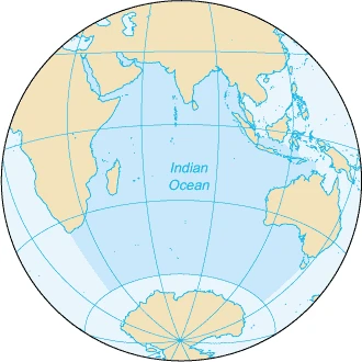
The Andaman Islands are an archipelago, made up of 200 islands, in the northeastern Indian Ocean about 130 km southwest off the coasts of Myanmar's Ayeyarwady Region. Together with the Nicobar Islands to their south, the Andamans serve as a maritime boundary between the Bay of Bengal to the west and the Andaman Sea to the east. Most of the islands are part of the Andaman and Nicobar Islands, a Union Territory of India, while the Coco Islands and Preparis Island are part of the Yangon Region of Myanmar. The islands are home to the Andamanese, a group of indigenous people including the Jarawa and Sentinelese. Some islands can be visited with permits, but entry to others, including North Sentinel Island, is banned by law; the Sentinelese are generally hostile to visitors and the Indian Government and Coast Guard prohibit approaches within 3 nautical miles to protect their right to privacy.
- Political status
- Mostly part of Andaman and Nicobar Islands, a Union Territory of India; Coco Isl
Verified Timeline
Lore & Background
The name Andaman appears in the 13th century in Late Middle Chinese as ʔˠanH dɑ mˠan (晏陀蠻) in Zhao Rukuo's Zhu Fan Zhi, where he notes that an unfavorable wind from Lambri (Sumatra) to Ceylon could drift ships toward the islands. In the 15th century, the Mao Kun map of the Wu Bei Zhi recorded them as 'Andeman Mountain' (安得蠻山). The oldest archaeological evidence for habitation dates to the 1st millennium BC, though genetic evidence suggests settlement after 26,000 years ago, possibly at the end of the Last Glacial Period when sea levels were lower. The Chola emperor Rajendra I took over the islands, using them as a strategic naval base against the Sriwijaya Empire; a Thanjavur inscription of 1050 CE calls the island Ma-Nakkavaram. European traveller Marco Polo referred to it as 'Necuverann', and a corrupted form of the Tamil Nakkavaram led to the modern name Nicobar. In 1789, the Bengal Presidency established a naval base and penal colony on Chatham Island, later moved to Port Cornwallis, but disease and death forced its closure in May 1796. After shipwrecked crews were attacked in the 1830s and 1840s, and the loss of the Runnymede and Briton in 1844, the British proposed a new settlement in 1855, delayed by the Indian Rebellion of 1857. Construction began in November 1857 at Port Blair using inmate labour. The Battle of Aberdeen was fought on 17 May 1859 between the Great Andamanese tribe and the British; a memorial now stands at the Andaman water sports complex. In 1867, the merchantman Nineveh wrecked on North Sentinel Island's reef; survivors were attacked with iron-tipped spears. The Cellular Jail at Port Blair, completed in 1910, included 698 cells for solitary confinement, each 4.5 by 2.7 m with a single ventilation window 3 metres above the floor. Indians imprisoned there called it Kala Pani ('black water'), referring to the Hindu proscription against crossing the open sea. During World War II, Japan occupied the islands, putting them under the nominal authority of the Arzi Hukumat-e-Azad Hind headed by Subhas Chandra Bose, who renamed them Shaheed and Swaraj. On 30 December 1943, Bose first raised the flag of Indian independence there. According to Werner Gruhl, the Japanese rounded up and executed 750 innocents before leaving. The penal colony was closed on 15 August 1947 when India gained independence, and now serves as a museum to the independence movement. Most of the Andaman Islands became part of the Republic of India in 1950 and a union territory in 1956, while Preparis Island and Coco Islands became part of Myanmar's Yangon Region in 1948.
Reader's Guide
The Andaman Islands offer a layered history for visitors. The Cellular Jail at Port Blair, with its 698 cells designed for solitary confinement, stands as a museum to the Indian independence movement. The Viper Chain Gang Jail on Viper Island was reserved for extraordinarily troublesome prisoners and was also the site of hangings. In the 20th century, it housed prominent members of India's independence movement. The Battle of Aberdeen on 17 May 1859, where the Great Andamanese tribe attacked the British settlement after being aided by an escaped convict from Cellular Jail named Dudhnath Tewari, is commemorated by a memorial at the Andaman water sports complex. For those interested in indigenous cultures, the Andamanese peoples—including the Jarawa and Sentinelese—have a genetic history suggesting settlement after 26,000 years ago. However, entry to North Sentinel Island is banned by law, and the Indian Government and Coast Guard prohibit approaches within 3 nautical miles to protect the Sentinelese's right to privacy; they are generally hostile to visitors and have had little contact with any other peoples. Some other islands can be visited with permits. The islands also have a surfing history: in April 1998, American photographer John S. Callahan organised the first surfing project, crossing the Andaman Sea on the yacht Crescent and surfing at Jarawa Point near Hut Bay and Kumari Point on Little Andaman Island. The resulting article 'Quest for Fire' in Surfer Magazine put the islands on the surfing map, and footage appeared in the film Thicker than Water by Jack Johnson. In November 2018, American missionary John Allen Chau traveled illegally to North Sentinel Island with the help of local fishermen.
Did You Know?
- The name 'Andaman' appears in the 13th century in Late Middle Chinese as ʔˠanH dɑ mˠan (晏陀蠻) in Zhao Rukuo's Zhu Fan Zhi.
- The Cellular Jail at Port Blair, completed in 1910, had 698 cells each measuring 4.5 by 2.7 m with a single ventilation window 3 metres above the floor.
- On 30 December 1943, Subhas Chandra Bose first raised the flag of Indian independence on the islands during Japanese occupation.
- The Indian Government and Coast Guard prohibit approaches within 3 nautical miles (5.6 km) of North Sentinel Island to protect the Sentinelese's right to privacy.
- In April 1998, American photographer John S. Callahan organised the first surfing project in the Andamans, resulting in the article 'Quest for Fire' in Surfer Magazine.
Geography & Strategic Position
The Andaman and Nicobar archipelago stretches across 836 islands, yet only 31 support human habitation. The territory splits into two principal clusters—the northern Andaman group and the southern Nicobar group—divided by the Ten Degree Channel, a waterway roughly 150 kilometres wide. Sandwiched between the Bay of Bengal on the western flank and the Andaman Sea to the east, the islands occupy approximately 8,249 square kilometres of land and were home to 380,581 people at the time of the 2011 census. Maritime boundaries bring the territory within 165 kilometres of Indonesia to the south, 280 kilometres of Myanmar to the north-east, and 650 kilometres of Thailand to the south-east, placing it at a crossroads of South and South-East Asian waters.
A Palimpsest of Empires and Colonies
The islands' past reads like a layered manuscript. Chola inscriptions from Thanjavur, dated to 1050, refer to the islands as Ma-Nakkavaram, meaning 'great open land' in Tamil. William Bolts briefly attempted an Austrian foothold between 1778 and 1783, while Archibald Blair established a British naval base in 1789 and a short-lived penal settlement on Chatham Island in 1794. The British returned in earnest in 1858, founding a new penal colony on Ross Island to house convicts from the 1857 rebellion. Japanese forces invaded during the Second World War, and after Indian independence in 1947 the region passed into the Dominion of India before becoming a union territory in 1950.
Isolation, Indigenous Identity, and Living Heritage
Archaeological investigation on the islands has focused largely on shell midden sites, and material evidence of civilisation stretches back roughly 2,200 years. The Nicobar group, by contrast, sat along a major maritime trade corridor linking South India to South-East Asia, yet because the indigenous communities possessed no written language, very few contemporary records survive from their own perspective. Travellers such as Faxian in the sixth century and Yijing in the seventh left only passing mentions. Today, the linguistic landscape is layered: Hindi and English hold official status, while Bengali, Tamil, and Telugu are widely spoken, and indigenous communities continue to use languages from the Andamanese or Nicobarese families. Hinduism is the majority faith, with a notable Christian minority. Perhaps the most striking testament to isolation is North Sentinel Island, home to the Sentinelese, a tribe that has never been in sustained contact with the outside world.
Tri-Service Command and Administrative Architecture
Administratively, the union territory is divided into three districts—Nicobar, South Andaman, and North and Middle Andaman—each with its own capital at Car Nicobar, Port Blair, and Mayabunder respectively. The territory's constitutional status evolved after 1947: initially a province of the newly independent Dominion of India, it was formally designated a union territory upon the adoption of the Constitution in 1950. The population, recorded at 380,581 in the 2011 census, is spread across just 31 inhabited islands out of the archipelago's 836 total. The blend of military significance, compact governance, and deep geographic remoteness—Port Blair sits over 1,190 kilometres from Chennai—gives the territory a character distinct from any other Indian administrative unit.
Frequently Asked Questions
Who is Andaman Islands?
An archipelago of roughly 200 islands sitting in the northeastern Indian Ocean, about 130 km southwest of Myanmar's Ayeyarwady coast. The vast majority of the territory falls under India as a Union Territory, though a few smaller islands like the Coco Islands and Preparis Island are claimed by Myanmar.
What are Andaman Islands's powers/role?
The islands serve as a natural maritime divide separating the Bay of Bengal from the Andaman Sea, giving them significant strategic importance for regional shipping lanes. They also function as a refuge for some of the world's most isolated indigenous communities, including the Jarawa and Sentinelese peoples.
How does Andaman Islands's story end?
There is no true ending, as the archipelago continues to exist as a living place today. Its most dramatic historical chapter—the British penal colony era—concluded decades ago, leaving behind a legacy of reclamation and restoration that still shapes the islands' identity.
Why is Andaman Islands important?
The islands are home to the Jarawa and Sentinelese, two of the last minimally contacted indigenous groups on Earth, making them a focal point for discussions on sovereignty and isolation. Their position at the crossroads of two major water bodies also makes them a key node in regional maritime security.
What links Andaman Islands to the Nicobar Islands?
The two archipelagos sit one north of the other and are administratively grouped together as the Indian Union Territory of Andaman and Nicobar Islands. Together they stretch across the boundary zone between the Bay of Bengal and the Andaman Sea, forming a continuous chain of volcanic and coral islands.
More in Islands Of The Indian Ocean 1-24
Spotted an error? Know more?
This is a living reference — every entry is fact-audited, and reader corrections feed straight into our audit queue. Suggest an edit · See this site's audit record